6 Amazing John Muir Trail Section Hikes
The John Muir Trail in 6 Convenient Sections
Want to hike the John Muir Trail but taking 3 weeks of work just isn’t an option? Maybe you couldn’t get a permit? Not a problem! The John Muir Trail can be broken up into 5-6 easily digestible chunks that can be hiked in less than a week and without having to resupply. You will still need permits, but for most of them the permits are much easier to get and can be reserved ahead of time online.
You can hike these sections in any direction or even combine them as your schedule allows, making permits even easier to get. They are also short enough to not require a resupply, making logistics simpler. For transportation options, check out our John Muir Trail Transportation Guide.
Happy Isles to Tuolumne Meadows, or Vice Versa (21 miles)
Location Yosemite
Trailheads Happy Isles, Tuolumne Meadows
Length 20
Duration 2-3 days
Difficulty Depends on direction
Season July through September (average), conditions permitting
Elevation 4,035 to 9,700 feet
Total Passes 1
Recommended Maps Yosemite High Country
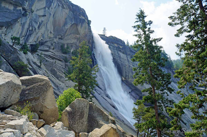
This is the most northern section of trail and stays entirely within Yosemite. It begins at Happy Isles, passes by two of the park’s biggest waterfalls, provides easy access to Half Dome and Cloud’s rest, and crosses Cathedral Pass before descending into Tuolumne Meadows. This is a section of trail that should be hiked by everyone, both JMT’ers and weekenders alike.
The logistics for this section are incredibly simple, with readily available public transportation between the two trailheads. The segment of trail between Happy Isles and Nevada Falls is the most heavily traveled part of the entire John Muir Trail as well as Yosemite National Park, but for good reason—these are some of the most impressive waterfalls anywhere in the world.
Over 6,000 feet of elevation is gained if you begin at Happy Isles, but the hike is predominantly downhill if you begin at Tuolumne Meadows. Permits are usually easier to get if you travel in this direction, but the trail is still not easy. The downhill has very steep, rocky sections with several steps carved into the granite, making it hard on your legs. Trekking poles are strongly recommended.
For permit and trailhead information visit: Yosemite wilderness permit information
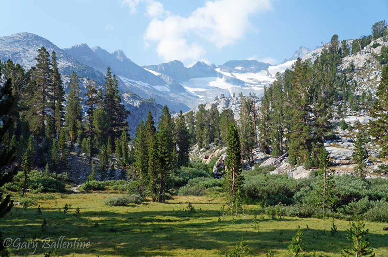
Tuolumne Meadows to Devil’s Post Pile (36.5 miles)
Location Yosemite, Ansel Adams Wilderness
Trailheads Tuolumne Meadows, Red’s Meadow
Length 36.5
Duration 3-4 days
Difficulty Moderate-Difficult
Season July through September (average), conditions permitting
Elevation 7,430 to 11,056 feet
Total Passes 2
Recommended Maps John Muir Trail Map Pack
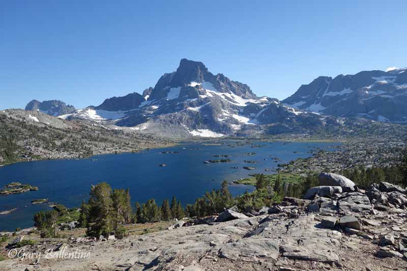
This entire section of trail is breathtaking. You begin in Tuolumne Meadows, a world-famous camping destination in its own right, climb Donahue Pass within sight of several glaciers, and descend over Island Pass and travel along the shores of Thousand Island Lake and Garnet Lake. This is not the biggest mountain scenery on the JMT, but it’s still plenty big and the views are some of the most spectacular anywhere on the trail.
Be prepared for company, as many hikers begin out of nearby trailhead Rush Creek for shorter trips, and nearly every JMT hiker has plans for visiting Thousand Island Lake. If you hike far enough around either lake you will almost always find solitude, however, and no camping is allowed within ¼ mile of where the trail passes by either lake anyway.
This is likely the most difficult section to get a permit for if you hike southbound, as you exit over Donaue Pass and will need an official JMT permit. If you hike northbound, however, permits are much easier to get and the Donahue exit quota will not apply.
For permit and trailhead information visit: Tuolumne Meadows Trailhead info, also Red’s Meadow Trailhead info
Thousand Island Lake to Devil’s Post Pile (30 miles)
Location Ansel Adams Wilderness
Trailheads Rush Creek, Red’s Meadow
Length 28-30 Miles
Duration 2-4 days
Difficulty Moderate-Difficult
Season July through September (average), conditions permitting
Elevation 7,430 to 10,205 feet
Total Passes 1
Recommended Maps Mammoth High Country or John Muir Trail Map Pack
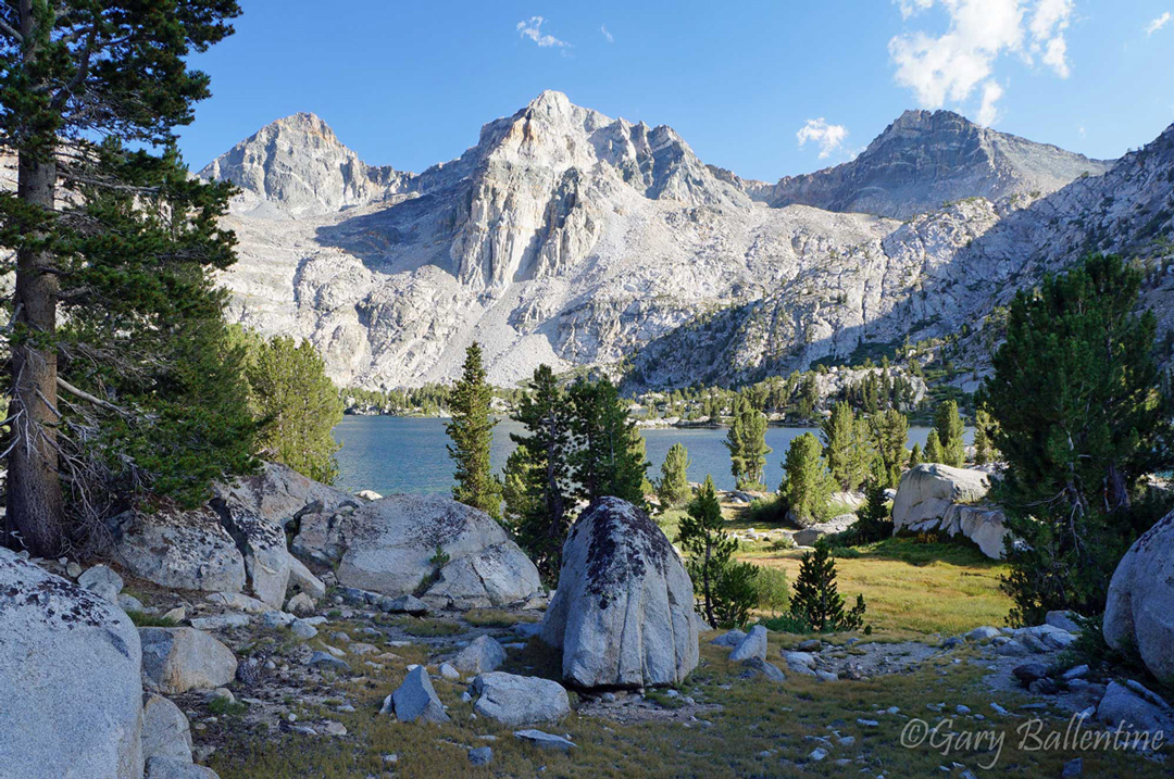
Purple Lake to Bishop Pass (85 miles)
Location Sierra National Forest, John Muir Wilderness
Trailheads Coldwater Camprgound, South Lake
Length 85 Miles
Duration 6-8 days
Difficulty Difficult
Season July through September (average), conditions permitting
Elevation 7,600 to 11,955 feet
Total Passes 5
Recommended Maps John Muir Trail Map Pack and Sequoia & Kings Canyon
This is not the most popular section of trail, but it definitely goes by some of my all-time favorite spots. It also skips the long, dry, and often hot climb from Red’s Meadow to the outlet of Duck Lake where it intersects the JMT.
You will see several highlights of the official John Muir Trail, beginning with Lake Virginia and Tully Hole, followed by Silver Lake, Marie Lake, and the all-famous Evolution Valley and Evolution Lake. You will also get to see the views from Bishop Pass with the option of camping in Dusy Basin along the Sierra High Route, a treat that many JMT’ers miss out on.
The trail does go up an absolutely grueling set of switchbacks from Lake Thomas Edison to Bear Creek, where there is a water crossing that you will likely be glad for. If you aren’t set on hiking every mile of trail, then you can take the ferry to Vermillion Valley Resort, enjoy a feast and complimentary beer, then begin your hike at the Bear Creek trailhead the next day, thereby avoiding this set of switchbacks.
For permit and trailhead information visit: Coldwater Campground Trailhead info, also Bishop Pass Trailhead info
Bishop Pass to Onion Valley (65 miles)
Location John Muir Wilderness, Kings Canyon National Park
Trailheads South Lake, Onion Valley
Length 65 Miles
Duration 5-6 days
Difficulty Difficult
Season July through September (average), conditions permitting
Elevation 8,000 to 12,130 feet
Total Passes 5
Recommended Maps Sequoia & Kings Canyon
If you’re a sucker for punishment but want to see some truly spectacular scenery, then this is the section for you. You begin at South Lake, go over Bishop Pass and down into LeConte Canyon, up the infamous Golden Staircase to Palisade Lakes, and top out at Mather Pass, where you will wonder just how exactly they managed to build a trail there. This is the last section of the trail that was constructed, with the engineers themselves not being quite sure at first.
You then pass by Lake Marjorie, over Pinchot Pass, and up to the ever-so-famous Rae Lakes. Rae Lakes is about as picturesque as Thousand Island Lake further north, but on average sees even more hikers due to its accessibility from Road’s End in Kings Canyon and the popularity of the Rae Lakes Loop that begins and ends there. You will also get to see Bullfrog Lake, Kearsarge Lakes, and Kearsarge Pass, all of which rival even the most intense beauty of the John Muir Trail, but are frequented by hikers beginning at Onion Valley.
This section hike is arguably the most impressive along the entire John Muir Trail, but is also the most difficult (despite not being the highest). The most popular spots, which are also the most beautiful, see heavy foot traffic from both JMT hikers and people on shorter trips. Solitude can be found here if you know where to look for it, but do plan to have to look for it.
For permit and trailhead information visit: Bishop Pass Trailhead info, also Onion Valley Trailhead info
Onion Valley to Cottonwood Lakes (50 miles)
Location John Muir Wilderness, Kings Canyon
Trailheads Onion Valley, Cottonwood Lakes
Length 50 Miles
Duration 4-5 days
Difficulty Difficult
Season July through September (average), conditions permitting
Elevation 9,185 to 13,180 feet
Total Passes 3
Recommended Maps Sequoia & Kings Canyon, Mt. Whitney Zone
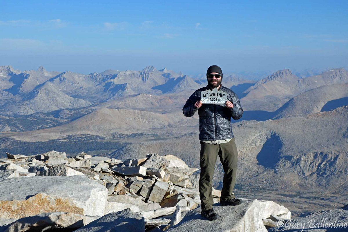
This section takes you over Kearsarge Pass and past Bullfrog Lake before going over Forester Pass, the highest pass along the John Muir Trail at 13,180 feet. If you expect the views to be phenomenal, you won’t be disappointed. You then begin your descent towards Tyndall Creek and Crabtree Meadows, providing easy access to the summit of Mt. Whitney. You can camp at either Crabtree or Guitar Lake before summiting, but keep in mind that anything above Crabtree Meadows is part of the Whitney Zone, meaning you will need to carry a wag bag in case nature calls.
While most JMT hikers will descend over Trail Crest to Whitney Portal, this will not be an option for you unless you were lucky enough to score a Whitney permit. If you hike this segment, you will almost certainly have to exit further south, with the Horseshoe Meadows and Cottonwood Pass Trailheads being your closest option. I would suggest exiting over New Army Pass to Horseshoe Meadows, as the views are more impressive than those from Cottonwood Pass.
For permit and trailhead information, visit: Onion Valley Trailhead info, also Cottonwood Lakes Trailhead info

Hi! I’m Gary. I’m the mountain-enthusiast and gearhead behind Granite Cliffs. My goal is to provide the inspiration and information you need to go outside and explore. This is my Adventure Portal.