Alternative Starting Trailheads for the John Muir Trail
Southbound or Northbound?
Can’t get a permit to start in Yosemite? Not a problem! Several alternative entry points exist for the trail, although most of them either add mileage or skip small sections. The most popular alternative entry options are at the southern end of the trail and have you starting on the eastern side of the Sierra in the desert, but some northern options do exist as well.
Hiking from north to south (southbound) is arguably easier because it saves the highest passes for after you have already acclimated. Hiking northbound from Cottonwood Lakes is the most popular alternative as you won’t miss as much of the trail, but is more challenging.
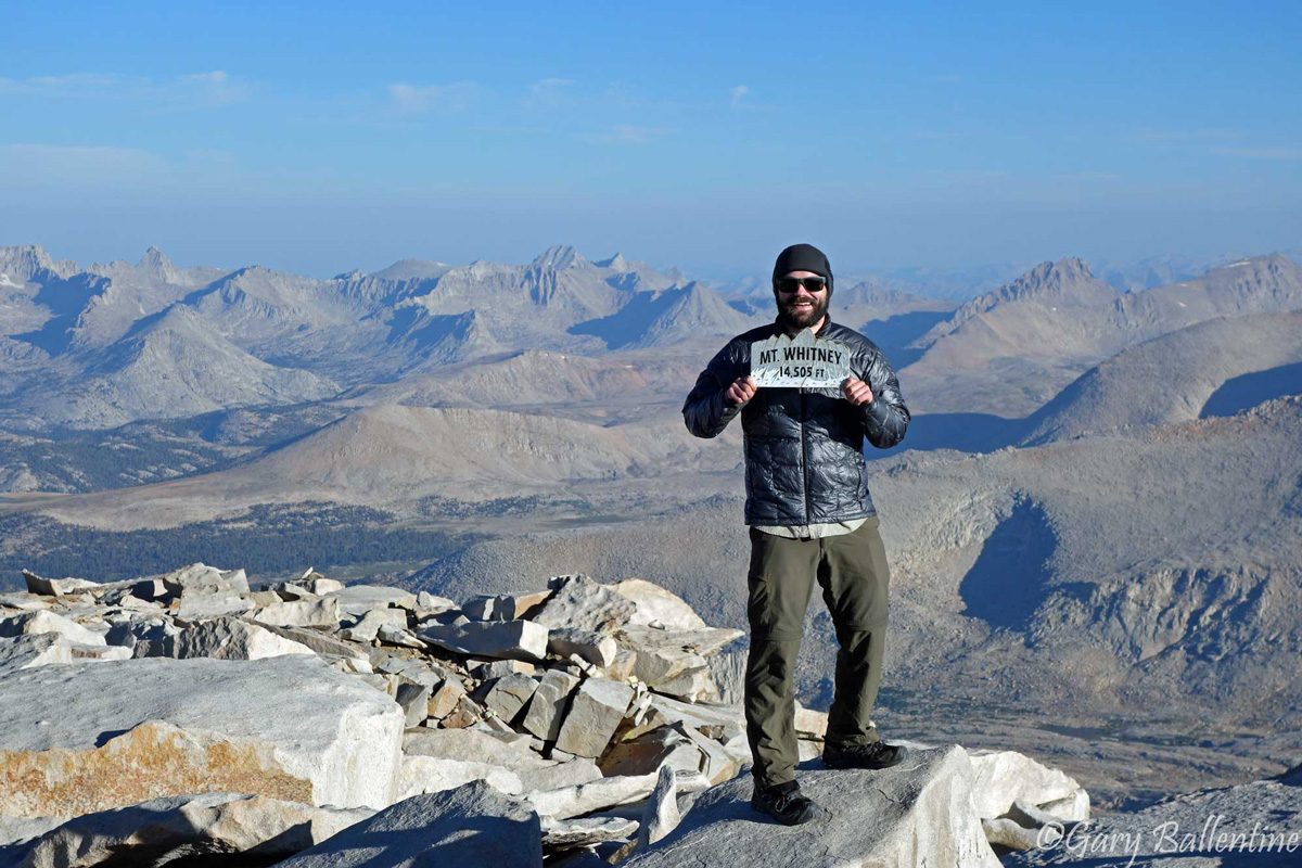
Climbing Mt. Whitney
Southbound
Mono Pass
Starting Trailhead: Mono/Parker Pass
Pass: Parker Pass (6 miles, 11,100 feet)
Distance to JMT: 21.1 miles near Island Pass
Section Skipped: Yosemite (40.2 miles)
Starting Elevation: 7,280 feet
Difficulty: Moderate-Difficult
Permit Required: Yes
Recommended Maps: JMT Map Pack, Yosemite High Country
On the far eastern edge of Yosemite, just 1.5 miles from the Tioga Pass toll plaza, is the Mono/Parker Pass trailhead. From the parking lot head south towards both passes, going past Mono Pass at 4 miles and reaching Parker Pass at 6 miles. You then go over Koip Peak Pass in another 3.5 miles, which is considerably more difficult at 12,270 feet, before finding campsites at Alger Lakes around 12 mile mark.
Alternatively, you can go over Mono Pass and camp at Summit Lake at the top or either of the two Sardine Lakes on the other side. This requires backtracking briefly in the morning, but avoids hiking two passes the first day and buys you time to acclimate for Koip Peak Pass, which is a good idea if you are coming from sea level.
Because this trail begins within the Yosemite National Park and not Inyo National Forest, you can exit at Whitney Portal if you begin here.
For permits and trailhead information, please visit https://www.nps.gov/yose/planyourvisit/wpres.htm
For more information on the trail itself, check out this page on yosemitehikes.com
Walker Creek
Starting Trailhead: Walker Creek/Bloody Canyon
Pass: Mono Pass (5.5 miles, 10,620 feet)
Distance to JMT: 22 miles near Island Pass
Section Skipped: Yosemite (40.2 miles)
Starting Elevation: 8,200 feet
Difficulty: Difficult
Permit Required: Yes
Recommended Maps: JMT Map Pack, Yosemite High Country
Just east of Yosemite and not far from Highway 395 is Forest Service Road 1S23/Sawmill Canyon Road. The road terminates just south of Walker Lake. From here, hike southwest directly past Sardine Lakes to Mono Pass at 4.4 miles, where you turn south. If you are not acclimated, it’s a good idea to camp your first night at lower Sardine Lake, but it does make for a very short first day.
Alternatively, you can keep hiking over Mono, Parker, and Koip passes, reaching Alger Lakes after about 13 miles. Tackling 3 passes your first day, including Koip at 12,270, is brutal and not recommended for anyone who is not acclimated.
The trail finally reaches the JMT just north of Island Pass after 22 miles. Because you are starting in Inyo National Forest and not Yosemite, you will either need a Whitney Exit Permit or exit at an alternative trailhead such as Cottonwood Lakes.
For permits and trailhead information, please visit https://www.fs.usda.gov/recarea/inyo/recarea/?recid=21234
Rush Creek
Starting Trailhead: Walker Creek/Bloody Canyon
Pass: Mono Pass(5.5 miles, 10,620 feet)
Distance to JMT: 22 miles near Island Pass
Section Skipped: Yosemite (40.2 miles)
Starting Elevation: 8,200 feet
Difficulty: Difficult
Permit Required: Yes
Recommended Maps: JMT Map Pack
Just south of Yosemite on the eastern side of the Sierra is an entry point near the June Mountain ski area. The trail is Rush Creek and is the primary access point for Thousand Island Lake, which can be reached in 7.4 miles, but the slightly longer route to Island Pass is strongly recommended because of the incredible views.
From the parking lot, head south and follow the signs for Gem Lake and Waugh Lake. This area is heavily trafficked and the trails are well-marked. In 9.6 miles, you will reach the John Muir Trail just north of Island Pass, which arguably has the best views of the entire northern section of the JMT.
From here, it’s 3.1 miles to Thousand Island Lake and 5.7 miles to Garnet Lake, both of which have excellent camping but are very crowded. Gem Lake and Waugh Lake, which you passed on the way, have excellent camping as well and are less crowded.
Because you are entering from Inyo National Forest, you will need a special Whitney permit or exit at one of the alternative southern trailheads.
For permits and trailhead information, please visit https://www.fs.usda.gov/recarea/inyo/recreation/recarea/?recid=20668&actid=51
Northbound
Cottonwood Pass
Starting Trailhead: Cottonwood Pass Trailhead Campground
Pass: Cottonwood Pass (4.1mi, 11,160 feet)
Distance to JMT: 21 miles to Crabtree Meadows
Section Skipped: Crabtree Meadows to Whitney Portal (18.7 miles)
Starting Elevation: 10,072 feet
Difficulty: Moderate
Permit Required: Yes
Recommended Maps: JMT Map Pack, Mt. Whitney Zone
From the Cottonwood Pass Trailhead Campground, head west for 4.1 miles, where you will meet up with the Pacific Crest Trail at Cottonwood Pass. Head North (right), and just after the pass is Chicken Spring Lake, which is small but has room for a few tents. From the pass, it’s about 9.5 miles to the Rock Creek ranger station, which has good camping.
Alternatively, you can head south 0.3 miles from the parking lot to the junction with the Pacific Crest Trail at Trail Pass, which makes it 5.8 miles to Cottonwood Pass. This route is longer but less steep and generally easier.
From Rock Creek it’s another 7.8 miles to the John Muir Trail at Crabtree Meadows. If you want to bag Whitney, which I highly recommend you do, then you can camp at either Crabtree Meadows or Guitar Lake. Guitar Lake is more crowded, but has better views and gives you a head start for Climbing Mt. Whitney.
Permits can be reserved here, but are becoming more competitive. 24 spots are available for reservation and 16 are available for walkups.
TIP: Camp near the trailhead your first night to help acclimate and start early the next day
Horseshoe Meadows
Starting Trailhead: Horseshoe Meadows/Cottonwood Lakes
Pass: New Army Pass (8.8 miles, 12,300 feet)
Distance to JMT: 21 miles to Crabtree Meadows
Section Skipped: Crabtree Meadows to Whitney Portal (18.7 miles)
Starting Elevation: 10,072 feet
Difficulty: Hard
Permit Required: Yes
Recommended Maps: JMT Map Pack, Mt. Whitney Zone
This route is roughly the same length as Cottonwood Pass but is both prettier and harder. From Horseshoe Meadows, hike west out of the parking lot, staying to the right at the first few junctions. In less than a mile, you will cross the south fork of Cottonwood Creek. The official trail goes to the right here and follows Cottonwood Creek proper, skirts the south shores of Cottonwood Lakes 1 and 2, followed by Long Lake and then High Lake. From here, switchbacks take you up the pass, which is a total of 8.8 miles from where you started.
Alternatively, if you go left at the junction at the south fork early on, an unofficial trail will take you to Cirque Lake, a short jaunt from the official trail heading up the pass.
From the top of New Army Pass, the switchbacks lead you down into a drainage that heads due west. Within a quarter mile of entering the trees again, you will reach a junction: to the right is Soldier Lake, and to the left is the Pacific Crest Trail. Soldier Lake is about a half mile to the north, roughly 12 miles from where you started, and is a good place to spend your first night. From Soldier Lake you can either backtrack to the PCT, or hike ~4 miles on a lesser-maintained trail to the Rock Creek ranger station.
The PCT is about a mile to the south of the junction for Soldier Lake. If you turn right on the PCT and keep going another ~5 miles the trail reaches Rock Creek, where there is good camping.
From Rock Creek, it’s another 7.8 miles to the John Muir Trail at Crabtree Meadows. If you want to bag Whitney, which I highly recommend you do, then you can camp at either Crabtree Meadows or Guitar Lake. Guitar Lake is more crowded, but has better views and gives you a head start for Climbing Mt. Whitney.
Permits can be reserved here, but are becoming more competitive. 36 spots are available for reservation and 24 are available for walkups.
TIP: Camp near the trailhead your first night to help acclimate and start early the next day
Shepherds Pass
Starting Trailhead: Shepherds Pass Trailhead
Pass: Shepherds Pass (10 miles, 12,025 feet)
Distance to JMT: 13.5 miles to junction near Tyndall Creek
Section Skipped: Tyndall Creek to Whitney Portal (26.3 miles)
Starting Elevation: 6,300 feet
Difficulty: Very Difficult
Permit Required: Yes
Recommended Maps: JMT Map Pack, Mt. Whitney High Country
At the end of US Forest Service Road 14S102 is a remote trailhead for accessing Shepherds Pass. It starts off at only 6,000 feet and follows Symmes Creek before cutting one drainage south towards Shepherds Creek. The 10 miles of trail leading to the pass is absolutely brutal, but it gives you great views of Mt. Tyndall and Mt. Williamson, both 14ers. Tyndall is a (relatively) easy class two climb from the pass and only 1-1.5 miles away. The Pass itself is only 3.5 miles from the John Muir Trail and another half mile to Tyndall Creek where there is good camping. The views are absolutely stunning.
The pass itself is north-facing and as a result has been known to hold snow well into summer, so early season starts are not advised. If you attempt this trailhead, begin your hike very early and bring lots of water. There is a very steep, hot, dry, and exposed section of trail for 4-5 miles after leaving Symmes Creek before you reach reliable water again. There is a lake just after the pass, and while camping is limited there, it is absolutely gorgeous and you will likely have it all to yourself.
For permits and trailhead information, please visit https://www.fs.usda.gov/recarea/inyo/recarea/?recid=20796.
TIP: It’s best to acclimate before attempting this trailhead, even if it just means camping near the creek the night before. This is also a viable exit trailhead if you can’t make it all the way to Horseshoe Meadows, but don’t plan on hitching a ride.

Hi! I’m Gary. I’m the mountain-enthusiast and gearhead behind Granite Cliffs. My goal is to provide the inspiration and information you need to go outside and explore. This is my Adventure Portal.