Understanding Weather and Trail Conditions in the High Sierra and on the JMT
Conditions and Weather Vary Wildly in the High Sierra
The Sierra Nevada is subject to a unique high altitude environment that is bordered on the west by a coastal Mediterranean climate, and on the east by one of the biggest desert regions in the world, the Great Basin. In the winter, much of mountain range receives heavy snowfall, often totaling more than 500 inches (40 feet) at the highest elevations. To complicate things, the entire mountain range is also subject to the North American Monsoon cycle, bringing unpredictable and intense storms during the summer months that interrupt its otherwise mild summer weather.

Understanding Snow Conditions
If you ask around, you will hear stories of epic winters and ‘snowpocalypse’ conditions lasting well into summer. You will also hear stories of dry years where hardly any snow fell. This is because winters in the Sierra can vary dramatically, making it very important to follow along with winter snow reports to get an idea of what summer conditions will be like. In the 2018-2019 winter, for example, most ski resorts in the Sierra received upwards of 600 inches, and some received over 700 inches (that’s nearly 60 feet of snow, or 18 meters). This compressed and settled into about a 20 foot (240 inch) snow base, and it took all summer to finally melt.
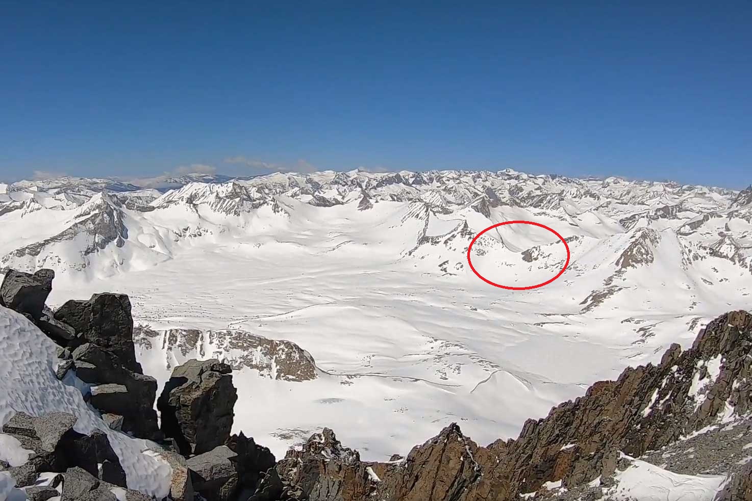
Of course, not all areas or elevations receive this much snow, but all areas above 4,000 feet do receive some snow. The passes and high peaks get the most, with the north facing aspects holding onto snow the longest due to less sunlight reaching them. The central and northern Sierra usually get more snow than the southern parts, and the west typically gets more than the east, but not always. Mammoth Mountain ski resort is a great example of this, and the John Muir Trail passes within a mile of its highest point. You can clearly see the summit chairlift from the trail, and in heavy snow years, the resort will stay open for skiing through July and sometimes August.
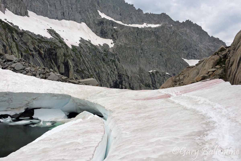
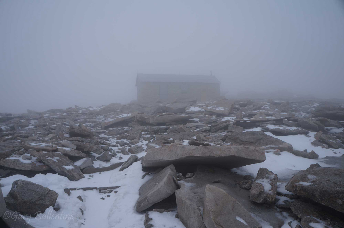
It’s important to account for the presence of snow when planning any Sierra hike. It is usually best to wait until most of it has melted, which is early July during normal years but can be sometime in August during heavy snow years. Snow travel requires the use of microspikes and sometimes an ice axe in the summer, and it can make travel up passes dangerous. It also reflects sunlight, turning the High Sierra into a giant solar oven.
The US Forest Service provides snow depth maps, and while they’re great starting points, they provide averages that do not account for drastic differences in depth within close proximity of each other (they are meant to assess drinking water resources). People putting boots on the ground will often give you information that is contradictory to these reports. Ski resorts measure snow depth and update their reports much more rigorously, making resources such as this very helpful in getting an idea of what maximum depths will be at high elevations (ski resorts record the deeper areas, not broad averages).
Water Crossings
One of the reasons it’s so important to follow along with snow depth is to be able to prepare for water crossings. When substantial amounts of snow still exist, water crossings will be very deep and swift. Hikers have been swept away and killed when crossing what are normally shallow creeks because of heavy snowmelt. The water crossing just north of Evolution Valley along the John Muir Trail can vary from a few feet to up to your armpits, and I encountered dangerous water crossings on the High Sierra Trail in late July of 2017. Over a mile of trail was flooded, requiring me to hike in water that varied in depth from a few inches to a few feet.

A section of trail in late July that was flooded for over a mile.
Mosquitoes and Biting Flies
The intensity of mosquitoes will vary dramatically from week to week and campsite to campsite, but their intensity can be predicted with relative accuracy based on—you guessed it—snowmelt! When an area first thaws in the spring or early summer and the snow melts away, life starts up again. Meadows flood, grasses sprout, fish and small mammals come out of hibernation, and the mosquitoes hatch.
For the first 3-4 weeks after an area fully thaws and daytime temperatures remain above 50F, the mosquitoes will come out in swarms that resemble dark, low-hanging clouds. They will be ferocious, swarming you even as you hike. Headnets, full raingear, and tents will be needed to protect you from their unrelenting thirst. The buzzing will drive some people mad, and bug spray will be needed like it’s sunscreen.
Wait a month after the initial hatch, and the intensity of the mosquitoes declines. If you wait a few more weeks still, they really won’t be that bad, and by late summer when nighttime temperatures start to drop again, they will be virtually non-existent.
The biting flies though? They love hot, dry conditions, especially at lower elevations, but can also be found higher up anytime the mosquitoes are bad (and even when they aren’t). They are harder to predict, but are also much less likely to be anything more than a minor annoyance.
Weather
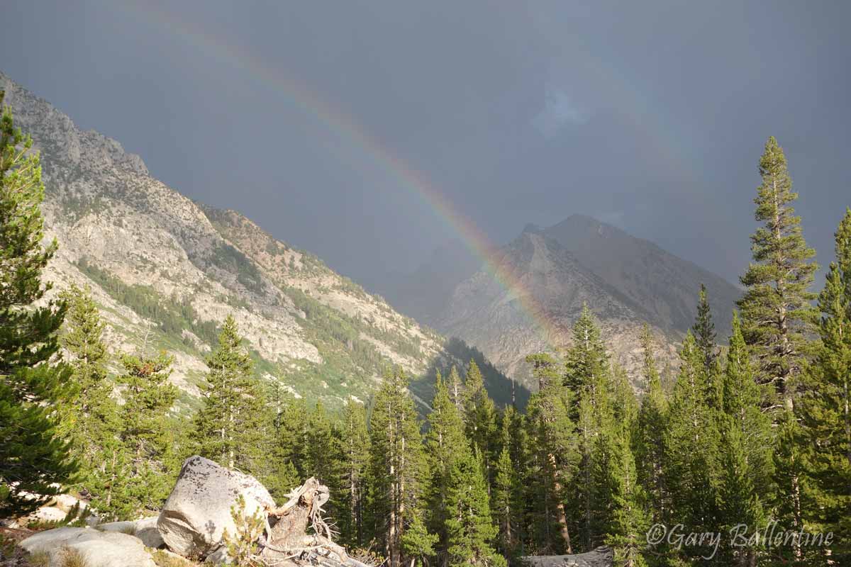
Summer weather in the Sierra varies as wildly as its winter weather. Summers can be hot and dry, with daytime temperatures at the lower elevations approaching triple digits and high elevations remaining in the upper 60’s and low 70’s. At least a few storms will hit the Sierra every summer though, and most summers will see several storm systems pass through. They almost always come from the Southeast, whereas winter storms almost always come from the Northwest.
The reason for this is the North American (aka Mexican) Monsoon that picks up in late June to July and continues through September. The extreme prominence of the Eastern Sierra causes significant uplift, making for an impressive show of lighting and heavy precipitation. Storms often hit unexpectedly and with a ferocity that startles new visitors.

It’s not uncommon to experience multiple consecutive weeks of very mild weather in the summer, nor is it uncommon to experience daily afternoon thunderstorms. When I hiked the John Muir Trail in August of 2013, I was snowed on at Thousand Island Pass, but had clear weather for the rest of the trail. In August of 2014, I encountered rain every afternoon on the High Sierra Trail, followed by heavy snow and intense lightning at Guitar Lake. In July of 2018, I experienced 10 consecutive days of heavy afternoon rain on the John Muir Trail, most of it freezing cold and accompanied by intense lightning and intermittent hail. It was so cold at night that my water filter froze solid inside my tent.
The point is, you need to be prepared for every type of weather imaginable in the High Sierra. Odds are you will have predominantly mild summer weather, but there is also a very real chance that you will be hit by severe storms. A High Sierra lighting storm is a true spectacle to behold, and has given me very humbling experiences that I will never forget. It is also a true hazard, and for this reason you should always plan to go over passes in the morning or very early afternoon to avoid being caught in one.
Forest Fires
Dry winters followed by summer lighting storms frequently spell disaster for the Sierra. The soil is very rocky with excellent drainage, and when the snowmelt tapers off, the ground and vegetation dry out quickly.
Large, destructive forest fires plague the Sierra annually, with dry years experiencing the worst of it. Late summer usually sees more large fires, as things have had more time to dry out. The Rim Fire, for example, began on August 17 of 2013 and burned 400 square miles. The Rough Fire ignited July 31 of 2015 and burned nearly 240 square miles. While it’s common for there to be many small fires in the Sierra, both of these fires grew massive due to high wind and very dry conditions.
You should always take note of both fires and fire danger when you plan your hike. If you hike in late summer of a dry year, it is likely that fires will already be burning when you begin and even more could start while you are on the trail. Keep a constant eye out for fires, always obey fire restrictions, and pay attention to signs and warnings posted by rangers. Rangers will make every effort to notify you if a fire is heading your way.
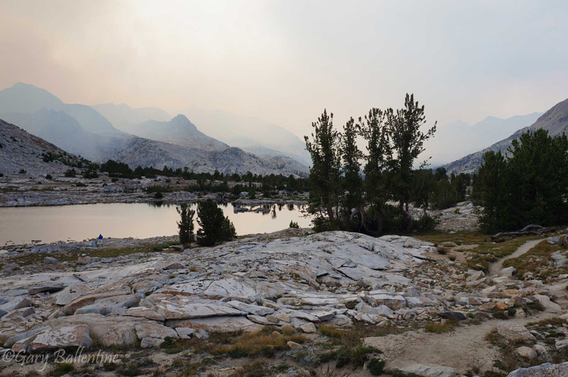
Keep in mind that the smoke from large fires will often rise up to high elevations in the afternoon and settle back down in low-lying valleys at night, while atmospheric currents will carry the smoke far away from its source. Just because you see smoke does not mean you are in danger, but it does mean you should stay alert.
Fire maps such as this are helpful when planning your hike.

Hi! I’m Gary. I’m the mountain-enthusiast and gearhead behind Granite Cliffs. My goal is to provide the inspiration and information you need to go outside and explore. This is my Adventure Portal.