A Guide to Hiking the High Sierra Trail
The High Sierra Trail traverses some of the most intense Mountain Scenery of the entire Sierra Nevada, and does so in just 75 miles. It begins on the western side of the Sierra in Kings Canyon National Park and reaches its highest point at the summit of Mt. Whitney, the tallest mountain in the contiguous United States. It crosses just two passes, but don’t let this fool you—the elevation is constantly changing, and so is the landscape. It rivals much of the John Muir Trail in beauty and can be hiked in less than a week!
Location Sequoia/Kings Canyon National Park
Trailheads Crescent Meadow to Whitney Portal
Length 75 Miles
Duration 5-7 days (average)
Difficulty Difficult
Season July through September (average), conditions permitting
Elevation 6,500 to 14,505 feet
Total Passes 2
Foot Traffic Moderate-Heavy
Weather Highly Variable
Permit Required Yes
Recommended Maps Sequoia & Kings Canyon
What Hiking the High Sierra Trail is Like
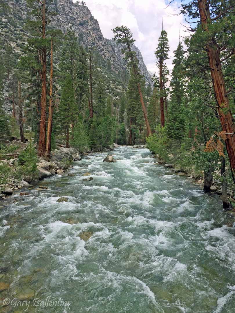
The High Sierra Trail passes through rapidly changing high altitude landscapes, ranging from impossibly big mountain scenery to deep gorges with flowing rivers and natural hot springs. It traverses steep cliffs with sheer drop-offs and breathtaking views, crosses dozens of streams and rivers, and puts you in the perfect position to summit Mt. Whitney without needing to apply for a Whitney permit.
How Long Does it Take?
The official High Sierra Trail is just 49 miles long, but terminates at Wallace Creek on the John Muir Trail. It’s possible to double back and exit where you started, but most people continue along the John Muir Trail and summit Mt. Whitney. Your High Sierra Trail permit allows you to exit at Whitney Portal, which few wilderness permits do, and is a major perk of hiking the trail. The HST is a strenuous trail with constantly changing elevation, so most people will give themselves 5-7 days to complete it.
When Should I Hike the High Sierra Trail
The hiking season for the High Sierra Trail is similar to the John Muir Trail. The best time is usually early July through the end of September, but this can vary wildly from year to year due to snowpack. The entire trail is high elevation and receives significant winter snowfall, with some sections remaining buried 8 months or more each year.
During normal years, the trail becomes passable without significant snow travel in early July, but in heavy snow years, it might not be safe until early August. Some sections are steep and very exposed where a slip could easily be fatal. These sections should not be attempted until they are completely melted out, so check on the reported trail conditions or call and ask if they aren’t current.
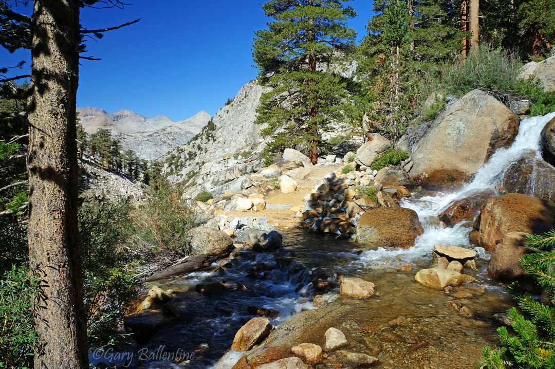
Water crossings are plentiful on the High Sierra Trail, and it actually has a lot more of them than the entire John Muir Trail. Crossings will be very deep and swift when the tail first becomes passable, so it is generally a good idea to wait a few weeks after the snow has melted. The big water crossing just east of Kaweah Gap can be especially problematic for shorter, lighter hikers in the early season.
Weather on the High Sierra Trail
As with the rest of the Sierra Nevada, the High Sierra Trail is subject to wildly changing weather that can vary from warm and sunny to freezing temperatures with rain, lighting, and even snow. My personal experience has been that the High Sierra Trail is subject to more frequent storms than many other parts of the Sierra, but this does not mean you will always get rained on. You might have warm sunny weather, and you might see thunderstorms every afternoon. To read more about weather in the High Sierra, check out this article.
How to Get a High Sierra Trail Permit
What Gear Should I Bring
Gear requirements for the High Sierra Trail are exactly the same as for the John Muir Trail, which is honestly the same as for most High Sierra treks. Check out this guide for a complete list of gear, and check out this guide for help choosing footwear. Not sure what the best way to filter water is? Check out this water treatment guide. My top food choices for backpacking are explained here
What to Expect
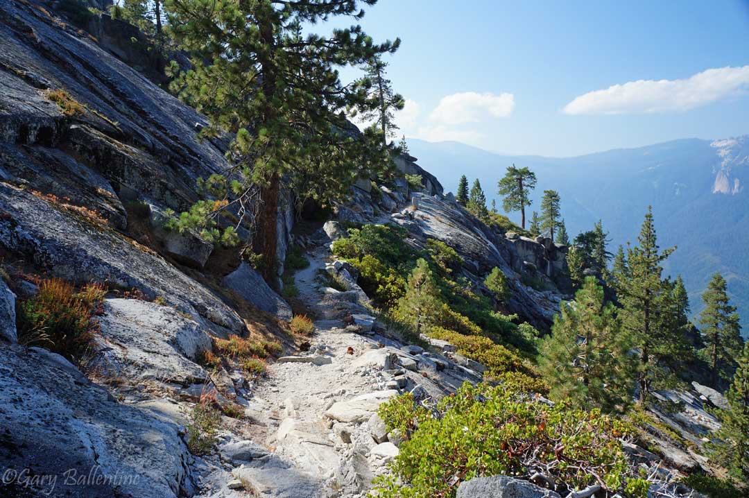
The trail begins in an ancient giant sequoia and pine forest at Crescent Meadows, not far from the famous General Sherman Tree, the largest in the world. The trail stays high on a ridge before the forest opens up into breathtaking views of the Kaweah River and the Great Western Divide. Shortly after the trail opens up, you cross 9 Mile Creek, the first place you are allowed to camp. As you might have guessed, it’s 9 miles from the trailhead.
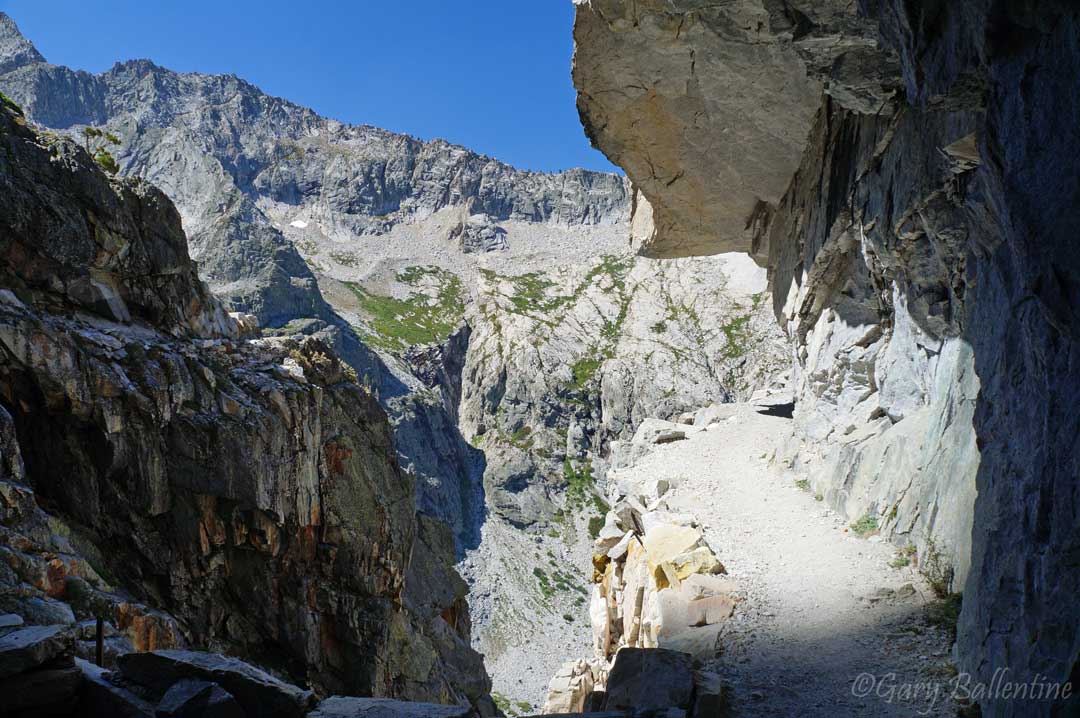
Bearpaw High Sierra Camp is the next landmark, and you will know why they built a camp here when you experience the views. From here you climb upwards along high cliffs, where you truly begin to realize the scale of these mountains.
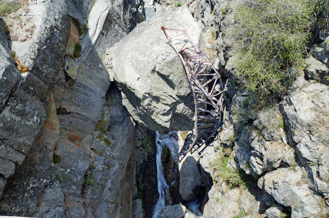
The trail then crosses a deep, narrow gorge on a wooden bridge a hundred feet above the river. If you look down, you will see the remnants of an old steel bridge suspended precariously on a boulder wedged between the gorge’s walls. This bridge was ripped out years ago after a heavy winter pummeled the Sierra with intense snowfall, high winds, and flooding.
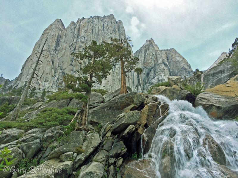
Just before reaching Lake Hamilton, you cross a massive waterfall that spills into the glacial valley of the Kaweah River. If you look up and to the left, you will see Valhalla Cliffs and the Angel Wings peeking into the clouds above their thousand-foot vertical walls. If you camped at Nine Mile Creek like most people do their first night, then you will likely camp at Hamilton Lake. The next section of trail is one of the most difficult and exposed, topping out at 10,600 feet above Precipice Lake.
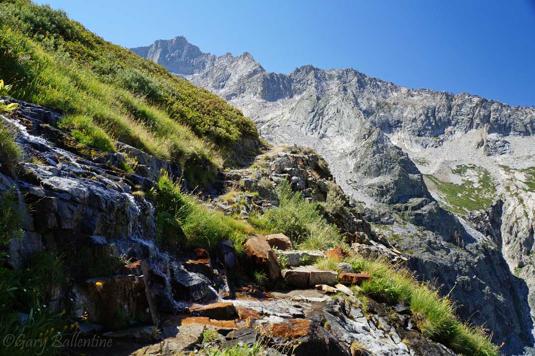
It’s best to hit this section early, as the climb up to Kaweah Gap is very strenuous. The climb above Hamilton Lake especially is steep and rocky, with several switchbacks and exposed sections on the very edge of thousand foot cliffs. The views are phenomenal, but be warned, if you have a fear of heights you will likely benefit from some hand holding here.
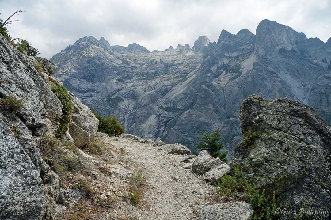
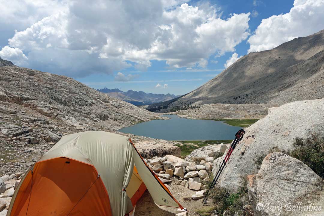
The trail crosses the Great Western Divide at Kaweah Gap, giving you incredible views of Eagle Scout Peak and Nine Lakes Basin. The basin has no official trails, but offers several days worth of exploring if you are feeling adventurous and want to extend your trip.
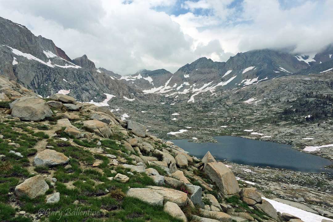
From the pass, you skirt along the south flank of the Kaweahs, which are some of the steepest and most notable mountains in the region. This section of trail has several water crossings, some of which are quite deep and swift during heavy snow years, so bring good trekking poles. From the junction at Big Arroyo, it’s just 2.6 miles to Five Lakes Basin, a worth-while side hike that will add a day to your trip. Your next good campsites after here are Moraine Lake and Sky Parlor Meadow on the Chagoopa Plateau, just below 13,802 foot Mt. Kaweah.
From the Chagoopa Plateau, you descend steeply into the Kern Trench, where the Kern River is crossed by a much-needed bridge. The Kern Hot Springs are a short distance from here, and their proximity to the river makes it easy to rinse off afterwards. The trail meanders 8.8 miles through this deep canyon past massive waterfalls that all feed into this enormous river. Just a mile before the climb back up there is excellent camping right along the river, giving you a chance at an early morning start to the steep ascent ahead.
About a mile past the final good campgrounds with bear lockers you begin a steep, hot, dry ascent towards Wallace and Wright Creeks. Don’t worry though, about 2 miles into it there is a much-needed water crossing just beneath a series of waterfalls. In another mile, you reach the John Muir Trail and the official terminus of the High Sierra Trail. If you weren’t able to figure out the logistics of an exit at Whitney Portal you can turn around and backtrack from here, reaching a total of 98 miles. With Whitney so close though, I really hope you figured out a ride! It’s a quick jaunt from here to Guitar Lake, where you should consider spending your final night before summiting.
There is a pit toilet at Crabtree Meadow, and I suggest you use it, because from here to Whitney Portal you are required to use a wag bag. The trail climbs steeply, giving you great views at Timberline Lake (which doesn’t allow camping), before entering the alpine zone and reaching Guitar Lake. Guitar Lake tends to get crowded, so try to get there in the early-mid afternoon. If you don’t and can’t find a spot, just climb another half mile to the tarns above the lake. They are often less crowded and still have great views.
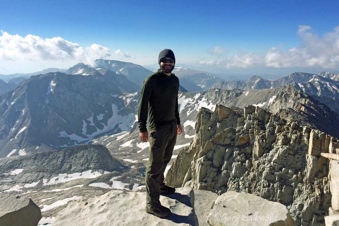
Set your alarm for 3 or 4 in the morning, because you have a chance to watch the sunrise from the summit of Mt. Whitney! It’s a steep and rocky climb to the junction near Trail Crest, where most people drop their packs and book it up to the summit with just a daypack. The last 1.9 miles to the summit isn’t as steep as the previous 3, but the thin air will have most people winded, so give yourself time and bring some warm clothes—it often gets below freezing up here before dawn, even in summer.
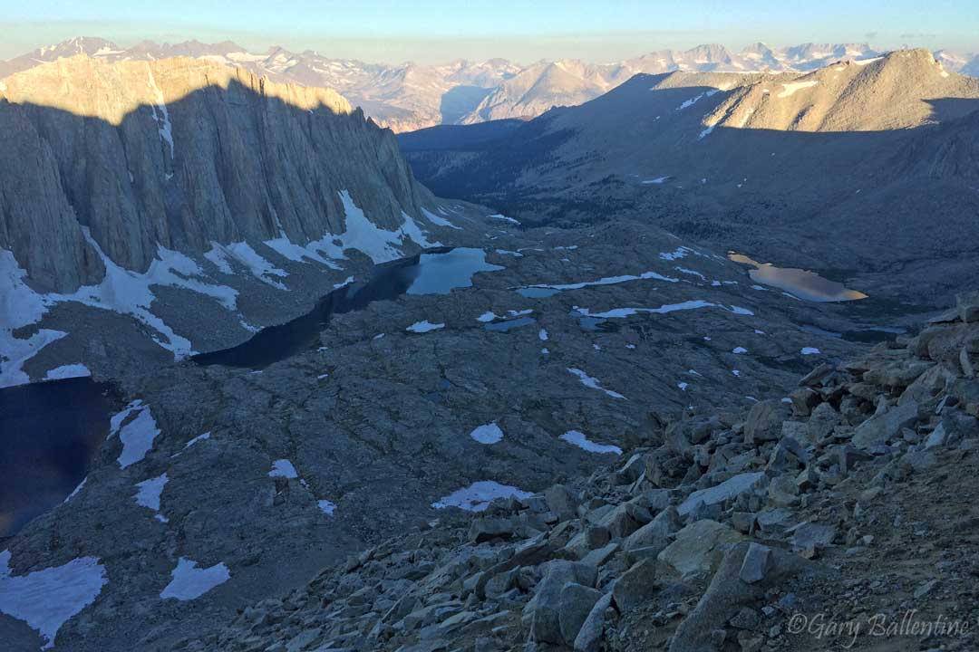
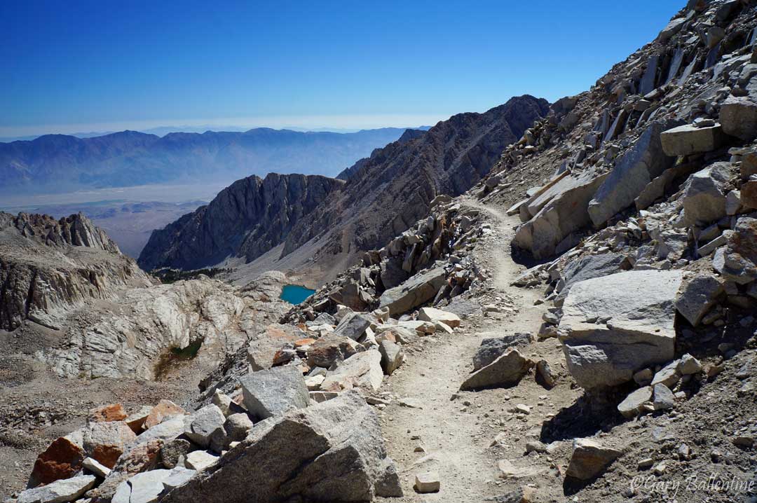
After watching what is probably the most spectacular sunrise of your life, you begin your victorious descent to Trail Crest and Whitney Portal. The descent from Trail Crest is steep, rocky, and riddled with hundreds of switchbacks. You will encounter numerous dayhikers who began at Whitney Portal, some of them having camped at one of the many small lakes along the way.
There is a freshwater spring right next to the trail a few miles down, which is your first place to fill up since Guitar Lake. The water is safe to drink, but has a slightly sulfurous smell, reminding you of where you are. If you hike a few more miles to Trail Camp or Outpost Camp, the water is much tastier. Get your permit handy, because there is a good chance a ranger will ask to see it before you reach the Portal.
When you reach the bottom, walk—no, strut—through the infamous gates of the Portal and enjoy the praise from random strangers who envy your climb of the tallest mountain in the lower 48. Grab a burger and fries at the Whitney Portal Store just a hundred yards away, or get a hearty breakfast at the Alabama Hills Café in Lone Pine. If you feel like you need to spend a night before driving back, there is a hostel in Lone Pine that is used almost exclusively by hikers.

Hi! I’m Gary. I’m the mountain-enthusiast and gearhead behind Granite Cliffs. My goal is to provide the inspiration and information you need to go outside and explore. This is my Adventure Portal.